Car Walk: Sands 9.00am


Carlisle & District Rambling & Fellwalking Club 


             This Weeks Walks

This Weeks Walks

It would be very much appreciated if all walk leaders submitted a description of their walk. Preferably by the Monday preceding the walk. Descriptions can be emailed to 

ramblingclubjohn@aol.com or telephone: 530306


Sunday 18th September 2016

A Walk

Langdale Edge

7 Miles Grade 2

Leader: Jenny Saint


Wednesday 14th September 2016
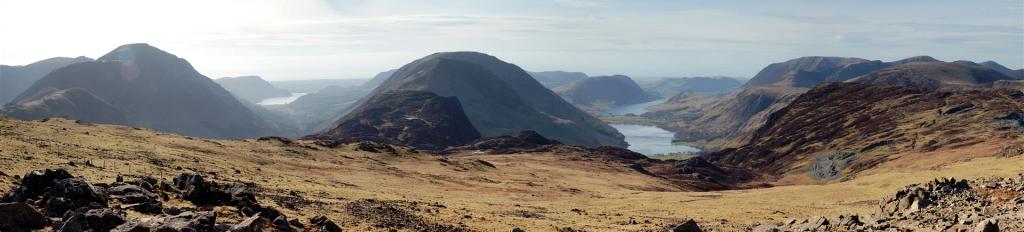
Rannerdale Knotts

6 Miles Grade 3

Leader: Tony Fenton


Sunday 18th September2016

Car Walk, Sands 9.00am


Car Walk: Sands 9.00am


Sunday 18th September 2016

B Walk

Aira Force & Glencoyne Head

8 Miles Grade 2

Leader: Ian Rowley


We’ll start from the carpark at the New Dungeon Ghyll Hotel. The first section aiming for Stickle Tarn is a rather popular route, which I suspect we will not be alone! We very quickly head uphill along a well-defined path which continues onwards and inevitably upwards. The scenery is dramatic so lots of excuses to take a pause, catch our breath and take in the views. We’ll start to gain height fairly rapidly as the path becomes steeper and, in places, turns into short scrambles over rocky outcrops. Nothing too demanding though. We’ll soon see the rewarding sight of Stickle Tarn below the stunning backdrop of Harrison Stickle and Pavey Ark. These summits together with Pike O' Stickle once formed part of the outer rim of a massive volcano. By this point we’ll have gained much of the height and be heading across a less trodden route.  Crossing over the stream heading East for Blea Rigg. We’ll follow the wide ridge which may have some boggy patches at times to Gt Castle How, Lt Castle How, Swinescar Pike, Lang How and eventually Silver How. From there we can start to drop down to Megs Gill and a path that takes us down past Thrang Crag to the roadway just before Harry Place farm. Our final section takes us right for a short way and we cross over to follow through on a lane heading back to Langdale beck on our left to the start. 
 
Note on the parking – I think this is a National Trust carpark. For non-members it costs £8 for the full day.
 
Jenny


X

Meeting at 09.15 at the Sands as usual, or at the most southerly car park alongside Crummock Water OS ref 163184 to start the walk at 10.30.
 
Starting from the car park the Knotts are reached after a relatively steep ascent for about 0.5 Km, gaining 260Mtr / 850ft. No rush to complete this bit!
 
We then head south east on the gently descending path before turning north west to follow the low level path to Rannerdale Bridge and a short distance on the road back to the car park.
Overall distance about 6 miles at grade 3. Refreshments afterwards in Buttermere. 
Should the weather be poor we have the option to walk round Buttermere.
 
Hope to see you there.
 
Cheers Tony.
 
 
Sands 9.15am


Thursday 15th September 2016

Last Thursday Walk of the Year - Cumwhitton Area

Sands 6.00pm

Leader: John McKay

Evening Walk Followed by Dinner (optional)

Pheasant Inn - Cumwhitton


X

This is a fairly adventurous walk but should be within the
capabilities of regular regular “B” walkers. It is a mountain walk
climbing to almost 2000 ft but most of the climbing is done gradually
in the first three or four miles.
Starting from Glencoyne bay NT car Park the route takes us to Aira Force, past the waterfalls and on up to Dockray. From there we’ll climb
gradually up to a fine path above Glencoyne Park giving views of
almost the full length of Ullswater. We’ll stop for lunch here with
most of the climbing done.
The next stage may require a head for heights as we traverse the sensational “miners balcony path” that hugs the hillside around
Glencoyne Head above a breathtaking hanging valley.
The path is well made, good under foot and generally dry but it is narrow and for short sections there are steep drops that might not suit everyone. The views are tremendous and the path circles the head of the
valley before crossing  the shoulder between Stybarrow Dodd
and Sheffield Pike,.
We can then descend via the good path over Bleabank Side and
down to  Seldom Seen and back to Glencoyne. 
A fine walk with lots of interest for  naturalists, geologists, archaeologists and ramblers!
 
Ian