This Weeks Walks
It would be very much appreciated if all walk leaders submitted a description of their walk. Preferably by the Monday preceding the walk. Descriptions can be emailed to
ramblingclubjohn@aol.com or telephone: 530306
This Weeks Walks

Thursday 5th July 2018
Evening Walk Followed by Dinner
Sands: 6.00pm
Both the walk and the dinner are optional
If you can't get to the Sands for 6.00pm you can come to the pub for 8.30pm
Dalston - Rose Castle - Bridge End - Dalston
Start - Bridge End Dalston
4 Miles Grade 4
Contact: John McKay - 01228 530306
X
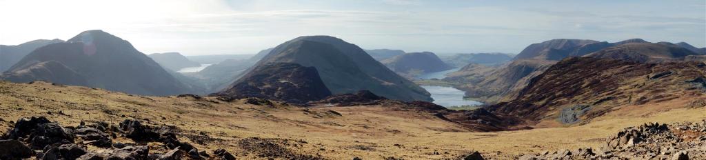
Sorry about another early start and long journey to Wasdale, but if you want to do these great mountains its got to be done.
Hopefully arriving at Wasdale Head by 10.00.am we have a nice easy start on a flat section. We then pick up a long path which gains height progressively that takes us to the foot of Lingmell. Its then around via Lingmell Gill for a longish ascent up Brown Tongue to Hollow Sones.
We then follow the path in an Easterly direction and take the final ascent path to summit Englands highest point. If we get going around 10am I would hope lunch will be on the top of Scafell Pike. With good weather we can sit and enjoy the views over our nosebag.
There are then a number of options open to the walker who is heading back to Wasdale. There is the Corridor route, but will make for a long hike and even longer day. Going back the same way, which may be the choice on the day depending on the weather. But the way I intend to go is via Lingmell. So its down the path we came up then straight across and up Lingmell.
This does give us a bit more of ascent but the goingis gentle and not long.
Lingmell is often past by for the higher hills that are on offer. This is as shame as the views across Piers Gill are some of the best in the area. Its then downhill all the way via the Lingmell path until we again pick up the gentler slopes heading North back to the cars. After hill drinks at Wasdale Head.
No scrambling involved. Good paths. Great views. Only just six miles but remember it is Englands highest mountain. Keep an eye on the site as again not going all that way if its a bad forecast.
Be there or be square…Pete….my number if required 07534 358550.
Wednesday 4th July 2018
A Walk
Scafell Pike
6 Miles Grade 1
Leader:Pete Rutland
Sands: 8.30am
X
X
Car Walk: Sands:9.00am
Sunday 8th July2018
A Walk
Helvellyn Horseshoe
9 Miles Grade 1
Leader: Bruce McMillan
Sunday 8th July 2018 - Car Walk: Sands: 9.00am
Car Walk: Sands:9.00am
X
Wednesday 4th July 2018
B Walk
Vertish Hill & Williestruther Loch
5 Miles Grade 3
Leader: Anne Halliday
Sands: 9.15am - Kilngreen Car Park Langholm: 9.45
Sunday 8th July2018
B Walk
Brampton Area
8 Miles Grade 3
Leader: Stephen Parker

Carlisle & District Rambling & Fellwalking Club
affiliated to hfholidays
We will park at low gelt car park and head off through the woods to middle gelt and from there on to the tiny hamlet og Greenvale (I think!!!) then we can make a decision depending on the group and the weather we can then either continue on towards Castle Carrock or alternatively head along the road back towards the railway line, the castle carrock option maybe adds a couple of miles but well worth the effort whilst we have the sun (either way we will end up back on the road to the railway line) from there it is through fields, paths and wooded areas back to the sand quarry and on to the cars.
Refreshments will be taken at Hayton Farm Shop. This walk will either be 8 or 10 miles depending on the optional extra being
taken or not.
Stephen
Our walk starts at the White Lion pub beer garden/car park.
We traverse a path below the slopes of Glenamara Park and Thornhow End. We cross Griesdale Beck to join the long and gradually rising approach to Striding Edge.
This leads to the “Hole in the Wall”, a stiled gap denoting the start of Striding Edge. It’s here that Helvellyn and its neighbour Catstye Cam first come into view above Red Tarn. Striding edge is the left hand side, an assortment of precarious paths threading the rocks. For those less confident there is a path on the Red tarn side at the end of Striding Edge. There is a short descending gully, best done facing inwards, a further easy scramble takes us to the summit, a flat plateau with a cross shelter from most winds. We cross the top and locate a low cairn at the top of Swirral Edge. The start of the descent is loose and exposed and care must be taken, haste is not an option. It soon ends and we are back on a path leading past Red Tarn and back to the “Hole in the Wall” and we retrace our steps back to Patterdale and well earned refreshments.
Bruce